South Moat Mountain

Atop South Moat Mountain in New Hampshire

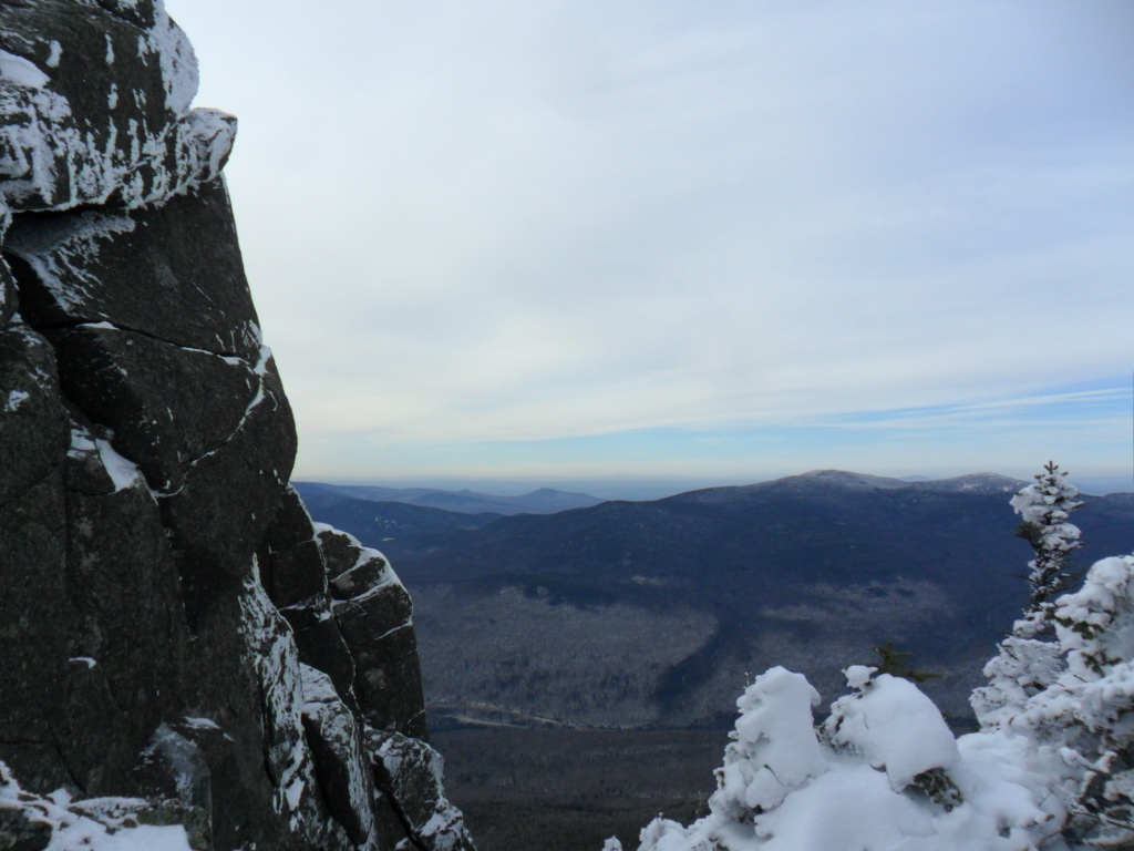
In the White Mountains, a northern section of the Appalachians, sits South Moat Mountain. This hike is not far from Conway, NH.

Winter hike up South Moat Mountain

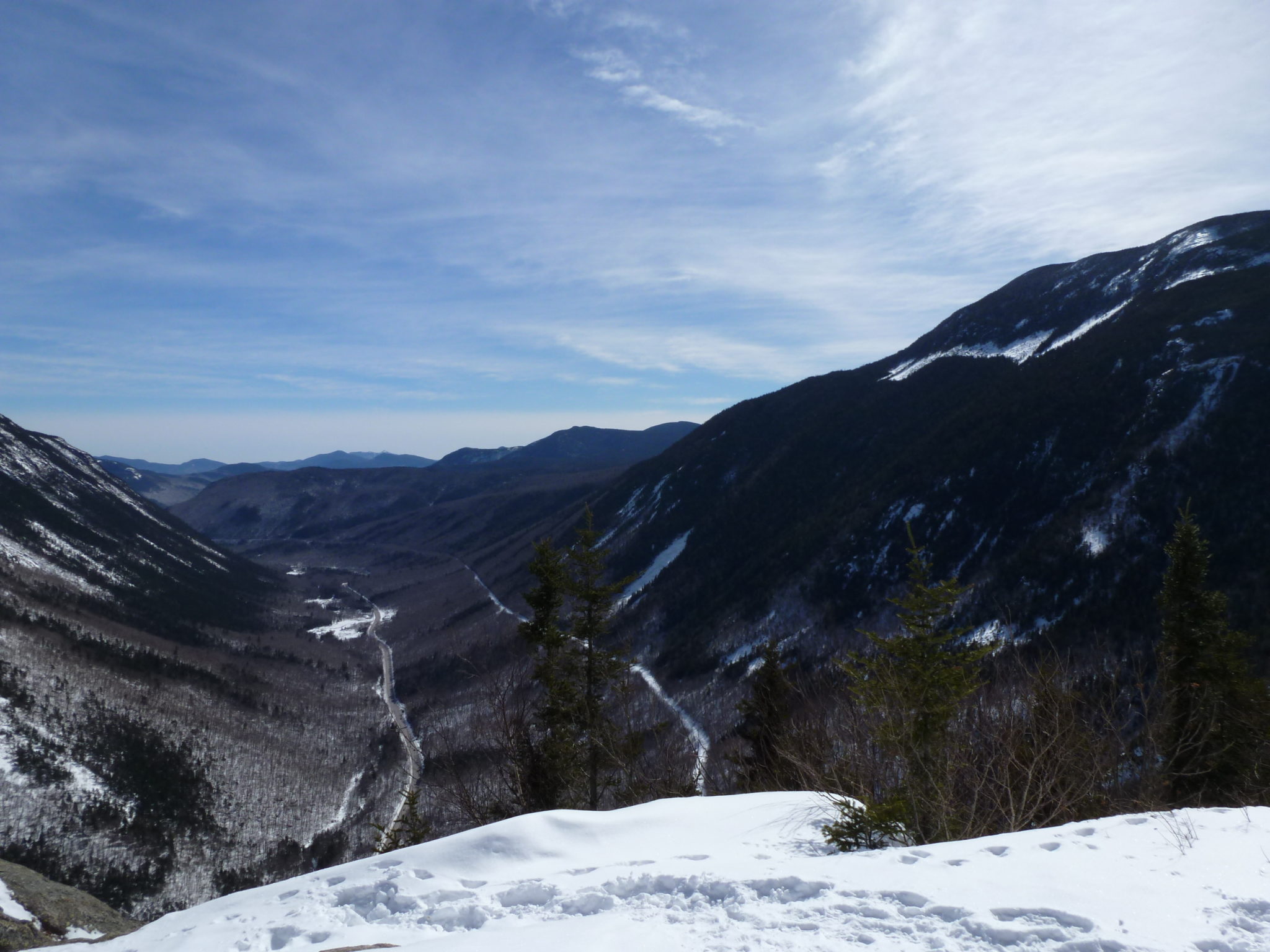
I went up in winter, so you may want to be prepared with snowshoes or winter traction for your feet. See if you can get an update on the recent trail conditions. Wool or a synthetic fabric that wicks moisture are good clothing options for the cold of a summit in New England in January.

South Moat Mountain hike with an overcast scene

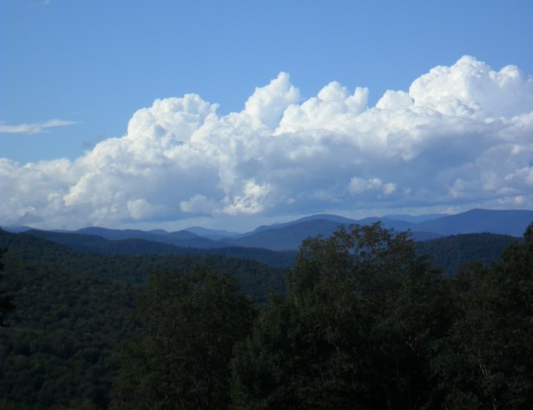
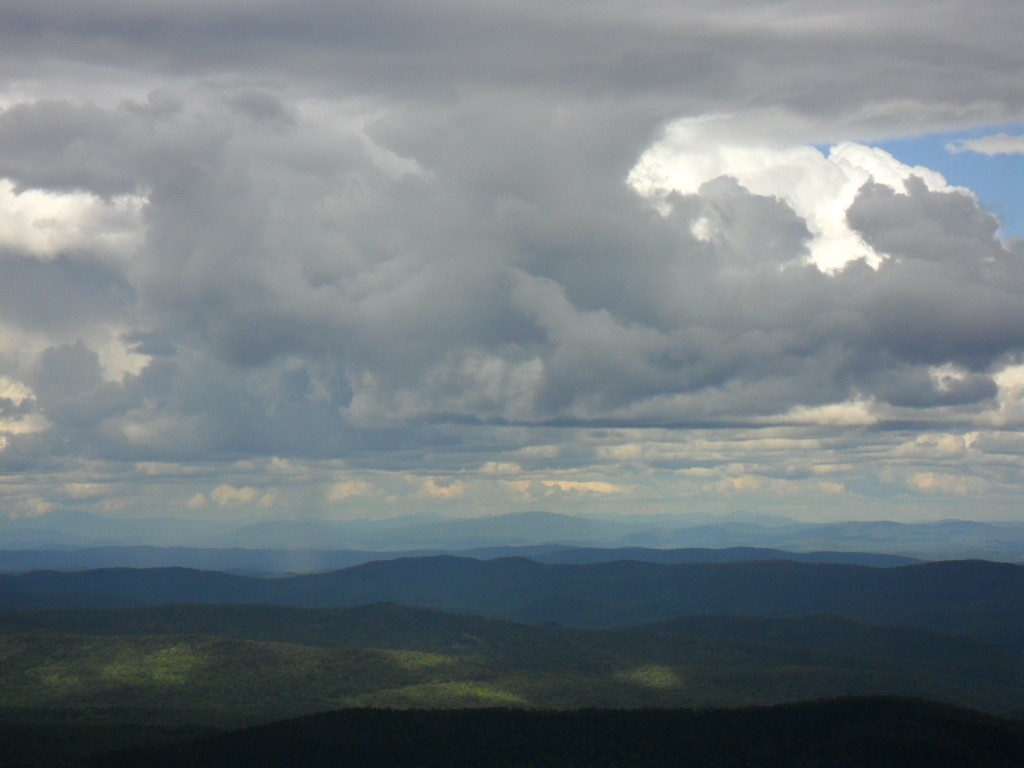
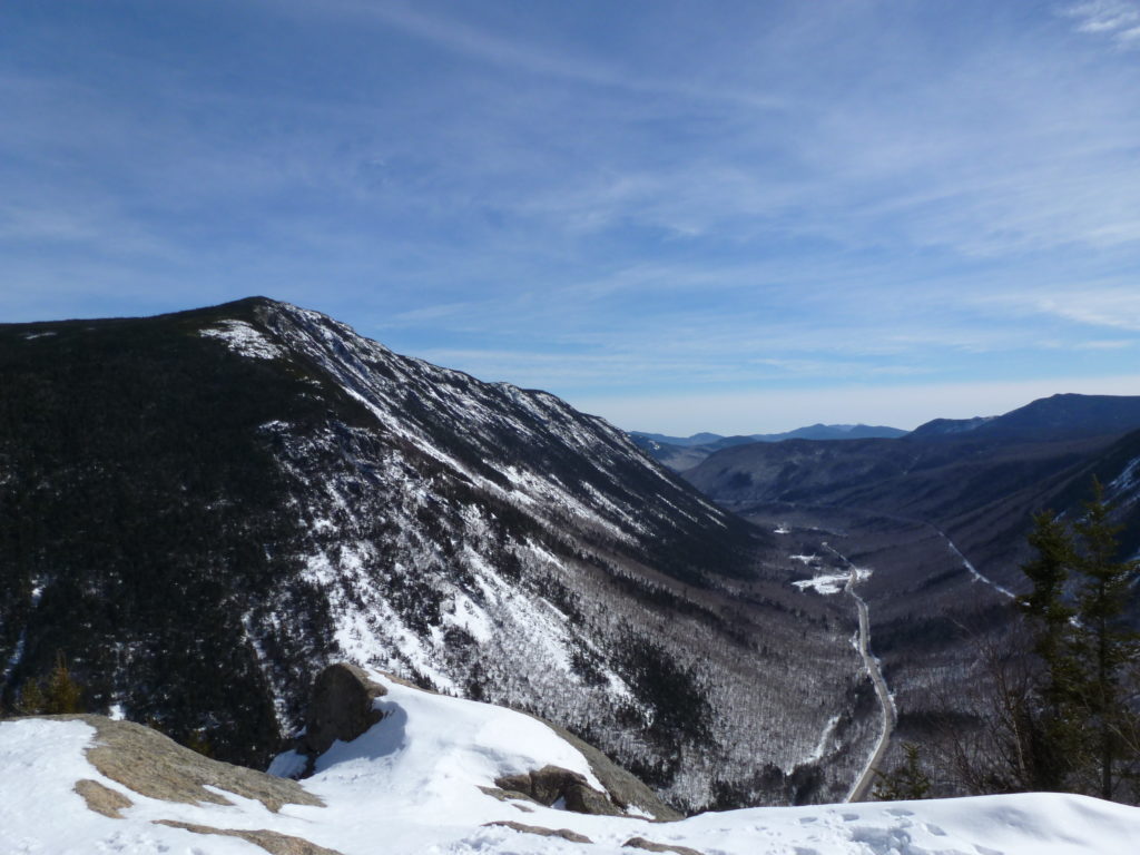
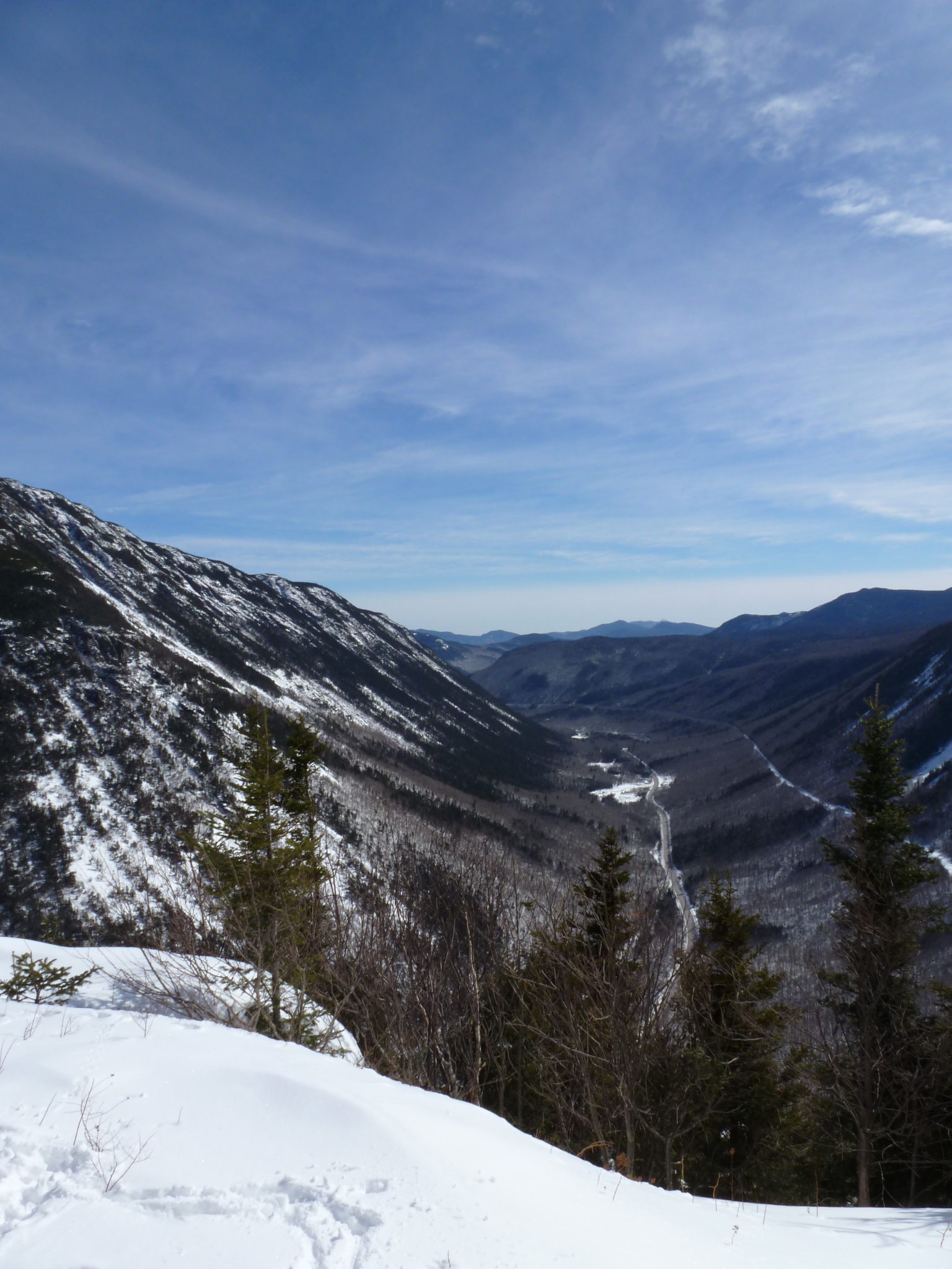
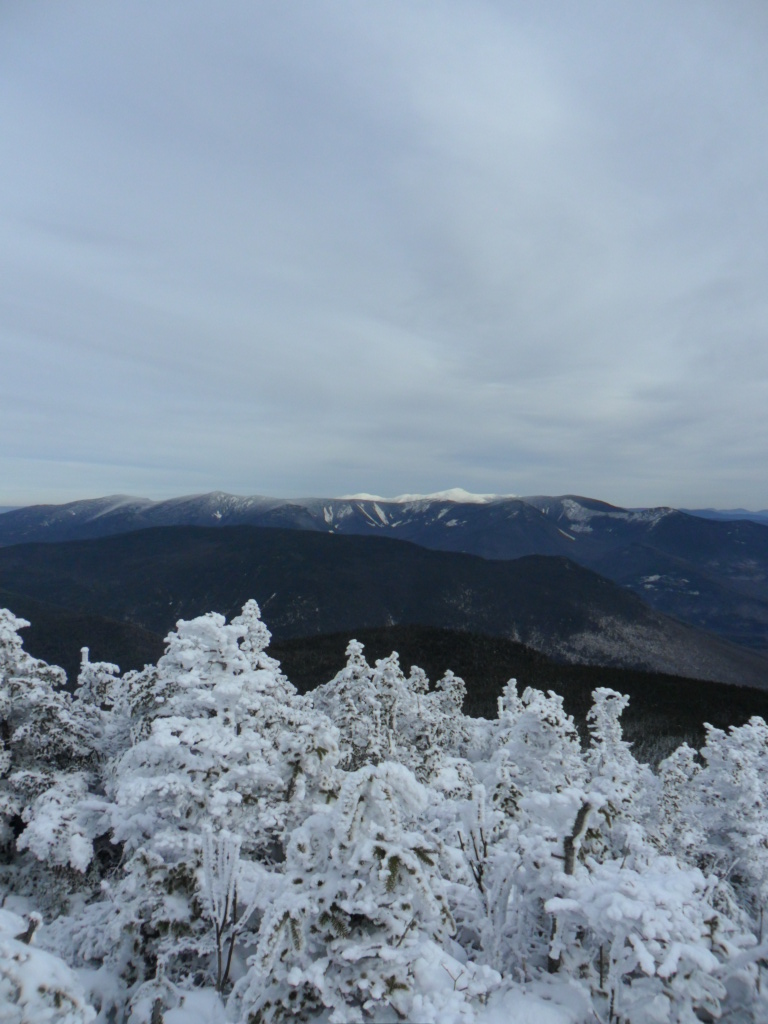
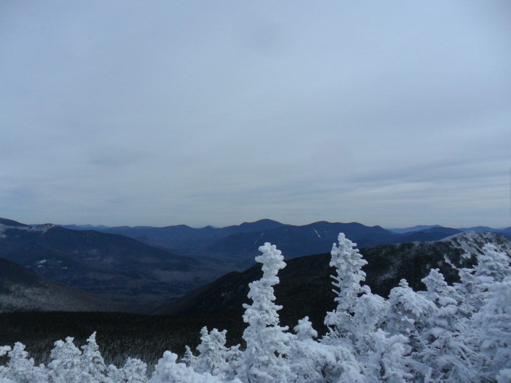
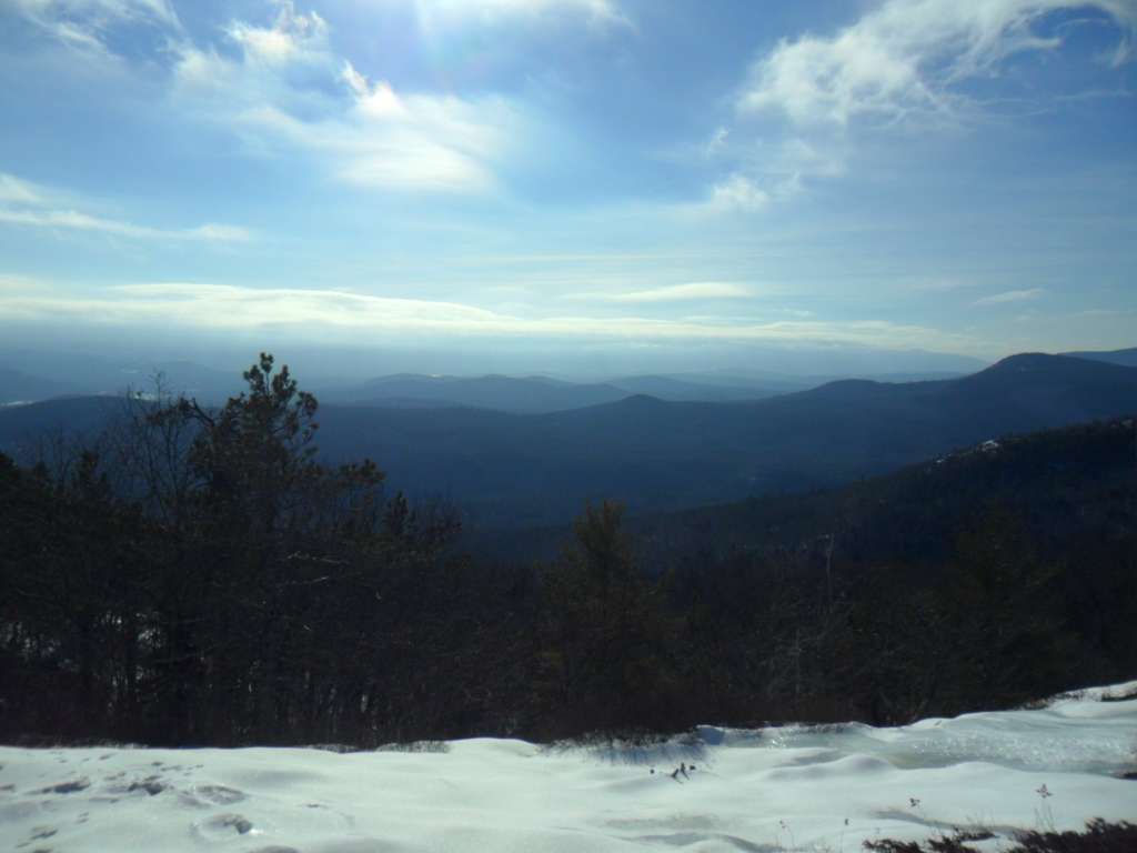
It was dark and overcast for a bit, but there were still nice views of the mountain ridges nearby. If you wanted to extend the day you could continue on to North Moat. That would add a few more miles to your journey.

South Moat Mountain

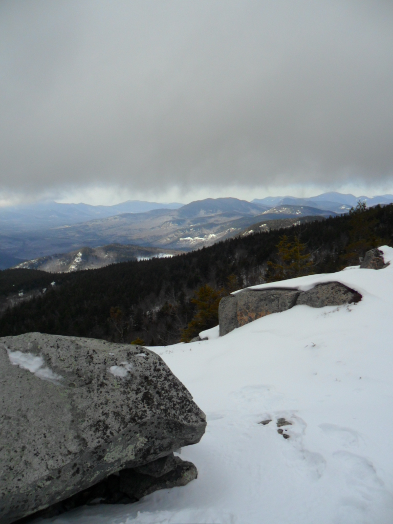
The hike is an up and back of about 5 miles. You can park by the southern end of the Moat Mountain Trailhead and take it all the way up. View a map of the trail. Have fun!


Killington Peak

One of the tallest mountains in the state, Killington sits in the Green Mountains of Southern Vermont. Better known as the location of a ski resort, these slopes are worth visiting in the summer too.

Killington Vermont hike in the Green Mountains

Multiple paths and trails can take you up to the peak of Killington from the parking lot of the ski resort. You’ll find yourself in the trees for a bit only to pop out in to the open fields of the ski slopes, then back into the cover of the trees again.

Because of the cleared slopes there are plenty of views below alpine. Additionally, the slopes become steep meadows with blossoming flowers in the warmer months. A summer storm suddenly passed over as I was hiking up the mountain. A little thrill, then it quickly went on its way.

Glimpse of a rainbow in Vermont

The top of the gondolas and a restaurant are on the peak. I came back down a different route than I came up. Once you’ve had your fun on top, really the choice is yours as to how you want to get back down. There are multiple options. Plan your ascent up with this trail map or add a little whimsy to your life and decide when you get there.


Mounts Avalon, Field, & Tom

White Mountains in New England during a hike

In Crawford Notch, next to the Presidentials, this hike encompasses three peaks in the White Mountains of New Hampshire. The loop hike covers a lot in roughly 6 miles.

White Mountains of New Hampshire in autumn.

The trail begins at the charming, old Crawford Notch Station along route 302. Climb the Avalon Trail through beautiful forest, and eventually along a brook. Stay on the trail all the way to the peak of Mount Avalon where there are really nice views of the always impressive Crawford Notch.

The smooth ridges of the old White Mountains.

When you’re ready to move on, you actually stay on the same trail all the way to the summit of Mount Field. From there, take a right on the Willey Ridge Trail. This will take you to the A-Z Trail. Take a right on the A-Z Trail, but only for a moment if you want to go to Mount Tom as well. From the A-Z Trail take a left up the relatively short Mount Tom Spur Trail to the top of Mount Tom and back.

Looking up at the autumn canopy of New Hampshire.

As you come down the Mount Tom Spur Trail take a left back on to the A-Z Trail. Stay on this trail until you are back merged on to the Avalon Trail. You are nearing the end of the loop. This time remember to stay left on the Avalon Trail, unless you want to go back up to the peak of Avalon! Continue on through the stretch of woods you immersed in at very beginning of your journey until you reach the parking lot of Crawford Notch Station. You’ll find gorgeous forest and multiple long distance views during this hike. View a trail map.


Mount Willard

View of Crawford Notch

Within the White Mountains of New Hampshire, Mount Willard is a short hike up and back with views of Crawford Notch to the east.

Crawford Notch from west

You start up the trail from the old Crawford Notch Station parking lot. Make sure to quickly take a left up Mount Willard Trail to its summit. A view of Crawford Notch is nice any time of year.

Mt Willard

I went up Mount Willard in March. Since the snow can slow you down, it’s nice to do the shorter hikes in the winter. It is the perfect time to bring a thermos with some hot tea for when you get to the top of the mountain.

Fox in Crawford Notch

Back down by the parking lot, I had a furry visitor come up to the car: a fox. You can park by the old Crawford Notch Station off of Route 302. The entire trip up to the summit and back is only a few miles. Get outside and enjoy!


Mount Liberty

View from Mount Liberty toward the east

This hike takes you to the peak of Mount Liberty along the Franconia Ridge. It is beautiful in any season. This time I went in November. If you go this time of year or anytime in the winter, be prepared with foot traction or snowshoes.

View from Mt Liberty

Walk along the Whitehouse trail on level ground for a while, then take a right over the Pemigewasset River and on up Liberty Spring Trail to the ridge. From there take a right and go south for a short stretch to reach the summit.

Hike up Mount Liberty

It is a pretty trek up the steep slope through the conifers. Once things open up on the ridge, you can look north toward Mount Lincoln and west to the Notch. The Presidential Range can be spotted to the east. If you want you can extend the hike north toward Mount Lincoln or south toward Mount Flume.

View from Mount Liberty

The whole out and back hike takes about 8 miles. It is easily accessible via the highway going through Franconia Notch in Lincoln, New Hampshire. As long as it’s not completely in the clouds, there are stunning views from Franconia Ridge any time of year. Enjoy!